What could be done now to reduce these impacts? These are the kinds of questions that motivated the development of the ShakeOut Earthquake Scenario, a comprehensive study of a magnitude 7.8 earthquake, led by the U.S. Geological Survey with the Southern California Earthquake Center, California Geological Survey, and hundreds of experts. The study was the basis of The Great Southern California ShakeOut, the largest earthquake readiness campaign in U.S. history.
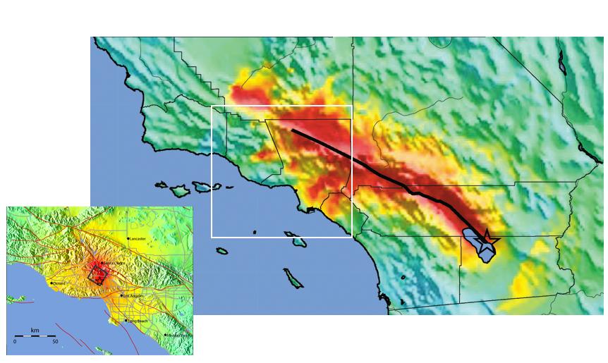
The “what if?” earthquake modeled in this study ruptures the southern San Andreas Fault for more than 200 miles (black line on map below). The epicenter is on the northeast side of the Salton Sea in Imperial County, though strong shaking will be produced all along the fault as it ruptures through the Coachella Valley, into San Bernardino, across the Cajon Pass and further to the northwest until ending near Lake Hughes west of Lancaster.
Larger imageShaking Intensities in the ShakeOut Scenario Earthquake An earthquake has only one magnitude and epicenter but a pattern of shaking intensity that depends on several factors. The strongest shaking (red on map) occurs very near the fault and dies off as seismic waves travel away. Away from the fault, in natural basins filled with sediments, some waves get trapped and reverberate, causing pockets of strong shaking (red and orange on map) that in this earthquake persist for as long as a minute. Ground shaking continues as the waves travel away, and in this earthquake, total shaking lasts for more than 3 minutes. The zoomed-in map shows the shaking intensities that occurred in the Northridge Earthquake. During the 1994 magnitude 6.7 Northridge earthquake, intense shaking affected a much smaller area and millions fewer people. Northridge was not a major earthquake and very few people have experienced one. Even for scenario experts, it proved challenging to think outside the “Northridge box” while studying a much larger earthquake. [Map credit: USGS]
As the rupture progresses it will offset the ground along the fault by more than 20 feet in places, and bend or break any road, railroad, pipeline, aqueduct, or other lifeline that crosses the fault. Overall the rupture will produce more than 100 seconds of shaking throughout Southern California. As shown in the large ShakeMap above, shaking will be strong along the fault but also further away where soil type, thickness of sediments, and other factors amplify earthquake shaking. In some areas, the ground will shift violently back and forth, moving nearly 2 meters (6 feet) in each second – shoving houses off foundations, sending unsecured furniture and objects flying.
The overall shaking in this earthquake will be more than 50 times the shaking produced by the Northridge earthquake (see zoomed-in map above). In addition, large earthquakes create earthquake waves that are never created by smaller earthquakes like Northridge. These long period waves can cause damage very far from the fault, and are especially damaging to tall buildings or certain infrastructure.
Finally, damage may also result when strong shaking occurs in areas prone to landslides and in materials that are susceptible to liquefaction whenever the groundwater is close enough to the surface. Maps of areas where landslides and liquefaction are possible in future earthquakes are available at https://www.conservation.ca.gov/cgs.
| 30 seconds | 60 seconds | 90 seconds | 120 seconds | 150 seconds | 180 seconds | 210 seconds | 240 seconds |
|---|---|---|---|---|---|---|---|
 |
 |
 |
 |
 |
 |
 |
 |
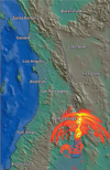
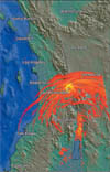
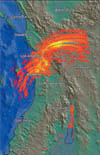
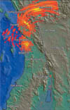
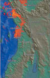
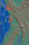
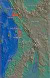
Earthquake Shaking Animation These computer-generated snapshots show maximum velocity of ground motion as the earthquake waves move out from the fault and travel through southern California. Snapshots are taken at 30, 60, 90, 120, 150, 180, 210, and 240 seconds after the fault starts rupturing. Yellow indicates the most damaging level, with orange and red also likely to cause damage. Note the persistent shaking in sedimentary basins where waves have gotten trapped and reverberate. To view the complete movie, visit urbanearth.usgs.gov/scenario08. [Images credit: Simulation by Rob Graves, URS Corporation, for the Southern California Earthquake Center on high-performance computers at the University of Southern California; images courtesy of Geoff Ely, University of California San Diego/San Diego Supercomputer Center]
How to Use the ShakeOut Scenario
The Scenario describes a what if earthquake, not a prediction. More than 300 experts from research, government, and private industry, led by the U.S. Geological Survey, collaborated to identify the physical, social and economic consequences of one plausible earthquake on the San Andreas fault. The full report is available at https://earthquake.usgs.gov/scenarios/catalog/sclegacy/. While this particular earthquake may never occur, that doesn’t limit the value of the study.
Looking in detail at one major earthquake provides insight into how to prepare for the other earthquakes that may occur instead. Thus, appropriate uses of the ShakeOut Scenario include:
- Urban planning;
- Emergency response training;
- School, business, and public earthquake drills;
- Prioritization of preparedness efforts;
- Understanding potential impacts on financial and social systems; and
- Identifying possible vulnerabilities of infrastructure, especially due to interactions among systems that are usually considered separately.
When a major earthquake does occur, it may be on a different fault, or create a different pattern of ground shaking and damage. Thus, inappropriate uses of the ShakeOut Scenario include:
- Deciding where to live or work;
- Concluding you don’t have an earthquake problem;
- Changing building codes; or
- Evaluating cost-effectiveness of mitigation.
